
Hiking holidays in Czechia: choose the right regions and routes
A hiking holiday in Czechia can take you from boggy uplands to challenging mountain trails. First choose your landscape, fitness level and travel arrangements: the Krkonoše, Šumava and Jizerské hory offer different routes, conservation rules and options for short or multi-day stays.
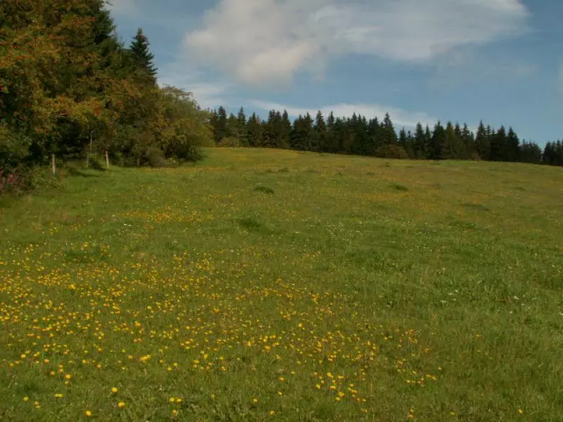 Wanderurlaub Tschechien
Photo: RRinnau
Wanderurlaub Tschechien
Photo: RRinnau
Hiking in Czechia: key facts
- Krkonoše (Giant Mountains): Suited to mountain hikes and trails at higher elevations. Harrachov, Špindlerův Mlýn and Pec pod Sněžkou provide access to different parts of the valleys.
- Šumava (Bohemian Forest): The choice of routes is shaped by peat bogs, forests and open uplands. An official circular route starting in Kvilda is 15.5 kilometres long, rated moderate, and listed as taking 4 hours 30 minutes with 282 metres of elevation gain.
- Jizerské hory (Jizera Mountains): Bedřichov is a good starting point for trails via Nová Louka and Kristiánov to the Královka viewpoint.
- Difficulty: Compare distance, elevation gain, terrain and the return journey. The landscape alone does not tell you whether a route suits your fitness level.
- Season: High-altitude conditions, weather, trail works and conservation rules can affect your plans. Winter services and snow conditions are not guaranteed.
- Getting around: Some trailheads can be reached by train or seasonal buses; make sure the connection and last return service fit your chosen hike.
Three regions, each with its own trail character
Krkonoše: plan mountain days around a convenient base
The Krkonoše Mountains are a good choice if you’re looking for high-altitude trails and longer day hikes. Harrachov gives access to the western part of the range, Špindlerův Mlýn to the central valleys, and Pec pod Sněžkou to the eastern approach to Sněžka. If you’re staying for several hikes, it’s usually easier to choose one base than to move from place to place every day. The mountain guide to the three Giant Mountains trailheads compares their locations and access.
Don’t plan a summit day alongside another outing far away. Choose a route you can shorten if the weather changes, and have a lower-altitude alternative in mind. Some sections of trails in Krkonoše National Park may be temporarily restricted. If a section is officially closed, you must not walk through the closure or bypass it off-trail.
Šumava: peat bogs, forests and a circular route with set distances
Šumava combines forest and peatland scenery with open uplands. For a specific moderate day hike, try the circular route from Kvilda to Jezerní slať, returning via Horská Kvilda and Filipova Huť. The national park authority lists it as 15.5 kilometres, of moderate difficulty, with a walking time of 4 hours 30 minutes and 282 metres of ascent. Use this as a planning guide, not a guaranteed time; breaks, terrain and your own pace will all make a difference. The overview of the Bohemian Forest introduces Kvilda and other parts of the region. For the exact route and map, see the official English-language route description from Šumava National Park.
If this route is too long, don’t simply try to complete the same route in less time. Choose a shorter marked trail and make sure the outward and return legs fit together. Peat bogs and sensitive natural areas are accessed via designated trails; taking unmarked shortcuts is not a good alternative.
Jizerské hory: uplands and a circular route from Bedřichov
In the Jizera Mountains, you can start your hiking day in Bedřichov and head via Nová Louka and Kristiánov, then towards the Josefův-Důl reservoir and Královka. This gives you a different option from the trails in the Krkonoše, which focus more on high summits. If you’re planning a circular hike, decide on the route and return to your starting point before setting off. The mountain guide to the Jizera Mountains explains the differences between Bedřichov, Jizerka and Liberec.
Choose a route to suit your fitness and travel schedule
For your first hiking holiday, a manageable circular route with a clearly defined start and finish is easier to plan than a long ridge traverse. Don’t look only at the distance: elevation gain, trail conditions, weather and possible shortcuts all matter. The Kvilda circular route in Šumava is explicitly rated moderate and makes for a long day of hiking. If you regularly hike in the mountains, use it as a benchmark and consider a longer high-altitude route in the Krkonoše. For a shorter trip, it’s worth choosing one region rather than several mountain ranges that are far apart.
In spring and autumn, wet ground, mud and shorter daylight hours can affect your choice of hike. In summer, more high-altitude trails are available, but leave yourself plenty of time for breaks and changing weather on longer routes. In winter, hiking, cross-country skiing and downhill skiing are different activities: not every marked summer trail is a suitable or open hiking route in winter. The overview of winter sports and activities can help you decide which kind of trip you’re planning; it does not guarantee snow or lift operations.
Plan your travel, return journey and accommodation together
For a point-to-point hike, you need to plan not only how to get to the start, but also how you’ll get back from the finish. Seasonal hiking buses may connect some valleys, but they don’t necessarily run every day or late into the evening. If the timetable doesn’t work with your walking time, a circular route, a second vehicle or an overnight stay at your destination may be more realistic. The Czechia travel planner can help you choose between train, bus and car.
For a stage in the foothills of the Krkonoše, you can consider accommodation in Mřičná as a base for local nature trails and the surrounding area. The village is in the foothills, not a convenient base for every summit trail; allow for extra travel time to reach higher elevations. If you’re hiking in the same mountain range for several days, choose accommodation closer to your planned trailheads and avoid unnecessary daily transfers.
Bring sturdy, broken-in shoes, weather-appropriate clothing, drinking water and a map in case you lose mobile reception along the way. Stay on marked trails and follow closure notices. Trails in national parks may be temporarily restricted for nature conservation or construction work; a marked closure is not an invitation to find an off-trail route through the countryside.
FAQ / Frequently asked questions about a hiking holiday in Czechia
Which region is best for a first hiking trip?
The key factors are trail length, elevation gain and access—not just the name of the region. Choose a marked circular route with a return journey you can plan. At 15.5 kilometres and rated moderate, the Kvilda route is not automatically a short beginner’s hike.
How long does the Kvilda circular route take?
The national park authority gives a time of 4 hours 30 minutes for the 15.5-kilometre route with 282 metres of elevation gain. Add time for breaks and your own pace; don’t plan your return journey based on that walking time alone.
Can I bypass a closed hiking trail?
No. Follow closures and local trail markings. The Krkonoše National Park authority also prohibits walking through closed sections or bypassing them off the permitted trail.
